UN
8 Colewood Drive
£ 705,000
Description
We don't have a Description for this property.
- Bedrooms
- 6
- Bathrooms
- 0
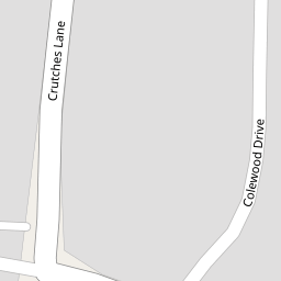


Leaflet © OpenStreetMap contributors
The heatmap indicates the level of crime in the area. The color of the heatmap indicates the crime severity and recency.
Metrics Year-on-Year
- Average area value
- 681,241.00 £Increased by 31.44 %
- Average area rental value
- 1,799.00 £/moIncreased by 16.06 %
- Est rental Yield
- 3.17 %Decreased by 11.70 %
- Crime Rate
- 4.00 %Unchanged by 0.00 %
from 518,274.00 £
from 1,550.00 £/mo
from 3.59 %
from 4.00 %
Nearby Schools
| Name | Type | Ofsted | Distance |
|---|---|---|---|
| Bligh Children'S Centre | Children's Centre | 0.74 KM | |
| Bligh Primary School (Infants) | Academy Converter | 0.93 KM | |
| Ebbsfleet Green Primary School | Free Schools | 0.93 KM | |
| Bligh Primary School (Juniors) | Academy Converter | 0.93 KM | |
| Strood Academy | Academy Sponsor Led | Good | 1.20 KM |
Images
Nearby Streets
| Name | Average Price | Average Sqft | Distance |
|---|---|---|---|
| Wakefield Close | £ 240,000 | 0 | 0.00 KM |
| Lincoln Close | £ 270,000 | 0 | 0.00 KM |
| Brice Road | £ 0 | 0 | 0.00 KM |
| A2 | £ 375,000 | 0 | 0.00 KM |
Nearby Transport
| Name | NLC | TLC | Distance |
|---|---|---|---|
| Cuxton | 5201 | CUX | 2.95 KM |
| Higham | 5202 | HGM | 3.22 KM |
| Strood (Kent) | 5191 | SOO | 4.95 KM |
| Halling | 5173 | HAI | 5.38 KM |
| Rochester | 5203 | RTR | 6.25 KM |
Nearby Listings
| Address | Price | Type | Score | Distance |
|---|---|---|---|---|
| Colewood Drive, Higham, Kent, ME2 | £ 700,000 | BUY | 7 / 10 | 0.02 KM |
| Sharfleet Drive, Strood, Rochester, ME2 2TY | £ 550,000 | BUY | 7 / 10 | 0.30 KM |
| Land on Old Watling Street, Rochester, Kent, ME2 | £ 150,000 | BUY | 6 / 10 | 0.30 KM |
| Old Watling Street, Rochester | £ 550,000 | BUY | 7 / 10 | 0.30 KM |
| The Shades, Strood, Rochester, Kent | £ 650,000 | BUY | Unknown | 0.31 KM |
Nearby Properties
| Address | Price | Distance |
|---|---|---|
| 6 Colewood Drive | £ 572,500 | 0.00 KM |
| 17 Colewood Drive | £ 565,500 | 0.00 KM |
| 13 Colewood Drive | £ 280,000 | 0.00 KM |
| 8 Colewood Drive | £ 705,000 | 0.00 KM |
| 15 Colewood Drive | £ 671,000 | 0.00 KM |